xbMaps is a Joomla component for displaying maps using OpenStreetMaps (OSM) tiles. Version 1.5.2 is the current release. Help links to documentation pages here are not complete.
 I have long wanted a non-googleMaps component to display gpx track in Joomla so that I could move my cycling blog from Wordpress to Joomla. Phoca Maps is the best available, but it wasn't able to display gpx tracks on OSM maps. I started by modifying Phoca Maps to display tracks with OSM, and rapidly found myself wanting to rewrite more of it. Jan at Phoca will be working on an update to Phoca Maps that may include more of the features from xbMaps and will be J4 compatible.
The primary intended user is someone needing to display OSM maps on a Joomla 3 site (I will not be developing for J4 for at least 5 years so don't even ask).
The component provides map (and track) views for the front end with associated descriptive text. Joomla categories and tags may be used.
A plugin to allow maps (with tracks and markers) and tracks from xbMaps to be embedded in a conventional Joomla article. A preliminary version of the plugin is available for download - it is still a bit rough around the edges but works ok for the basic options. There is help text on the plugin page once you have installed it.
4th January 2024 J3
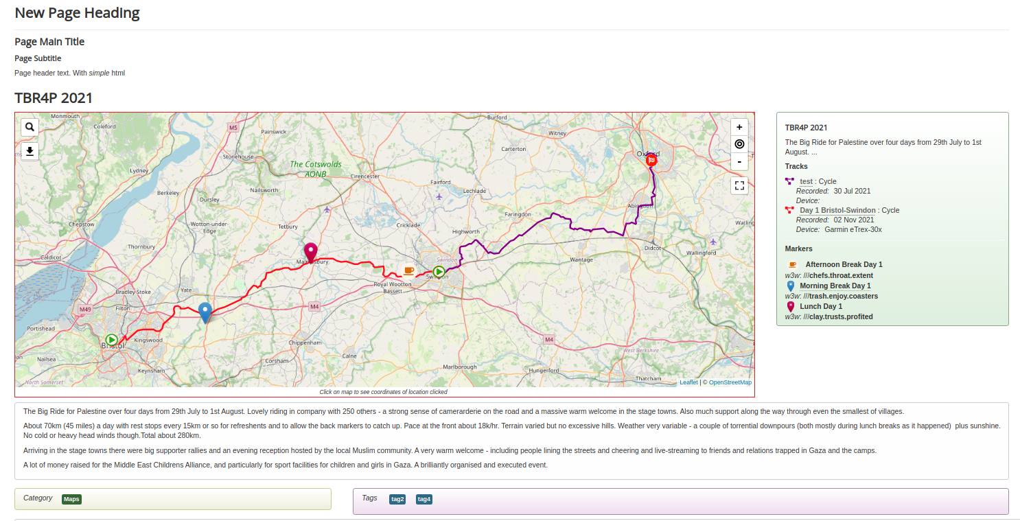
xbMaps manages three types of item: maps, markers, and tracks.
A map will show a defined area and may have many tracks and markers displayed on it. It also has optional controls for zoom, search, download, and more.
A marker may be a simple blue pin, a custom image, or one or two font-awesome icons (the optional second one overlaid on a base icon). The icon colours can be customised. Clcking on the marker optionally displays a popup with title, description or location info.
A track is a gpx file overlaid on the base map with a start and finish marker. The track display colour can be customised. An optional popup on the track or markers can show a description and basic stats from the gpx file (distance, moving speed, cumulative height climbed)
Standard Joomla tagging and category facilities are provided - the display of tags and categories on the front end is optional. By default four categories are created - maps, markers, tracks and uncategorised.
A folder to store custom .png images for markers is created at /images/xbmaps/markers so that standard Joomla media tools can be used to manage them. A folder for .gpx tracks is provided at /xbmaps-tracks and gpx files can be uploaded from the track manager. A folder in the /images area can be designated as an alternative but does require adjustment to the Joomla media options to accept .gpx files.
For further information see the xbMaps Documentation page
Improvements and bug fixes
- v1.0 - first release
- v2.0 - Joomla 4 compatible version (probably will never happen)
- v4.0 - Joomla 4 native version
... please report any bugs or problems on GitHub
Possible New features
- map control to search w3w
- map control to change tileset on the fly
- optional elevation plot
- front-end editing and creation of maps
Potential Modules and Plugins
- plg_button_xbmaps
editor extension plugin to facilitate entering xbmaps shortcodes in articles - mod_xbmaps_cat
module with list of items in a category - mod_xbmaps_tag
module listing items with a tag - mod_xbmaps-mini
module to show a minimap
... suggest your own ideas on GitHub
Changelog - click here